What AI Saw on a 1600 Map of O Dowdes Countrie
May 1, 2026 2026-05-01 1:57What AI Saw on a 1600 Map of O Dowdes Countrie
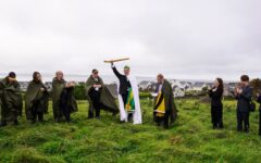
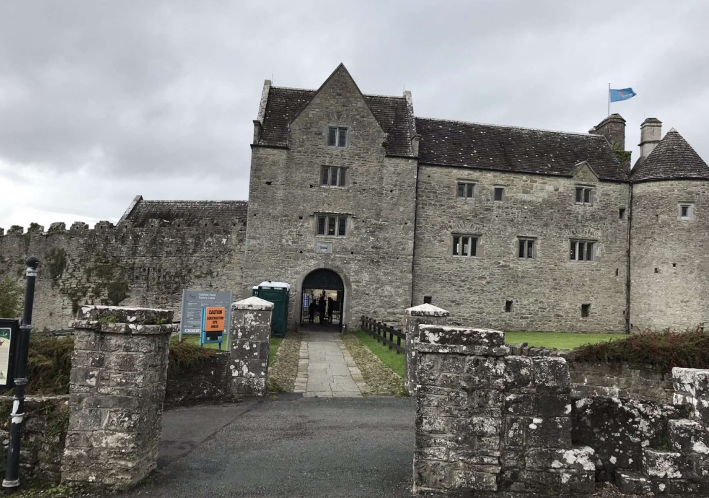
I took my children to Parke’s Castle one afternoon, on the kind of haphazard family stop you make when you’re driving across the country and somebody says they need a break. We wandered through the courtyard. They climbed the arch. I took a few photos.
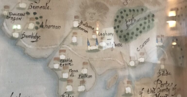
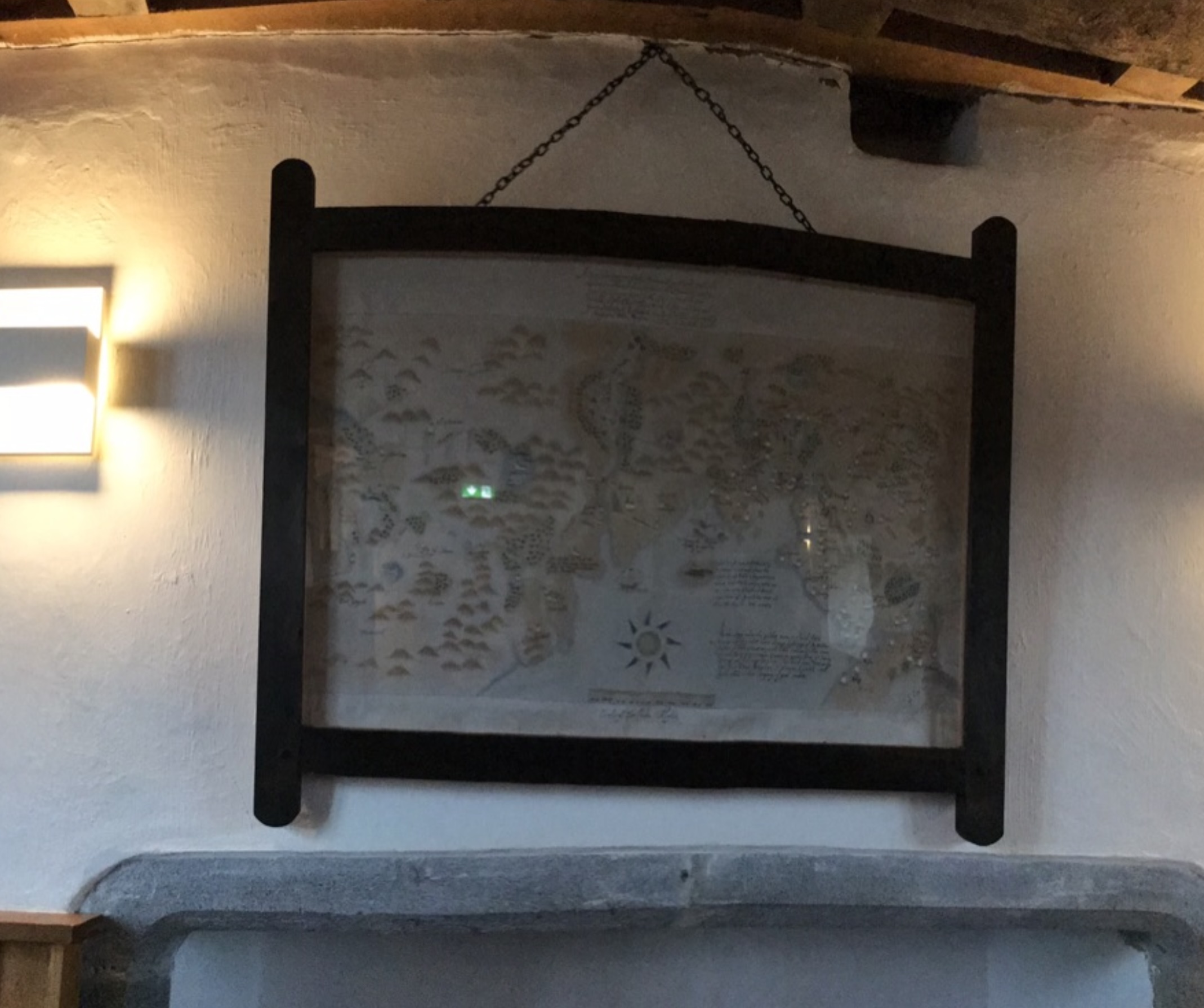
Inside, on the wall, was a hand-painted map of north-west Ireland — labels in old cursive, brown ink for the towers and trees, the long Sligo coast curving along one side. And written across the centre of it, in faded letters: O Dowdes Countrie.
I didn’t think much of it at the time. I took a photo, the way you do, and we left.
Years later I asked Conor Mac Hale — the clan’s working historian and the man who sourced our castle inventory — where he had found some of the place names that anchor our research. He told me Parke’s Castle was one of them. The wall map there had pointed him to references he then chased into the archives. The map at Parke’s is a faithful reproduction of a manuscript drawn around 1600 by Captain John Baxter and Baptista Boazio, now held at the Royal Museums Greenwich (catalogue P/49(7), Dartmouth Collection). It is the earliest known map to write O Dowdes Countrie across the page in red ink.
Conor’s lead opened the door. We have used the Baxter map ever since to identify lost castles, confirm spellings, and trace the territorial reach of the clan in the late sixteenth century. We thought we had read it carefully.
We had not.
A second pair of eyes
This year our research team has begun using AI as a reading partner — not as an oracle, but as a second pair of eyes for dense archival material. We feed it high-resolution scans, ask it to transcribe every label, every flourish, every mark of ink, and to tell us where on a modern map each one sits. It is patient in a way humans are not: it will read the same square inch of a map for the third hour without skimming.
While re-reading the Baxter sheet, AI flagged something we had walked past on every previous pass. Something I had walked past in person, that day with my kids.
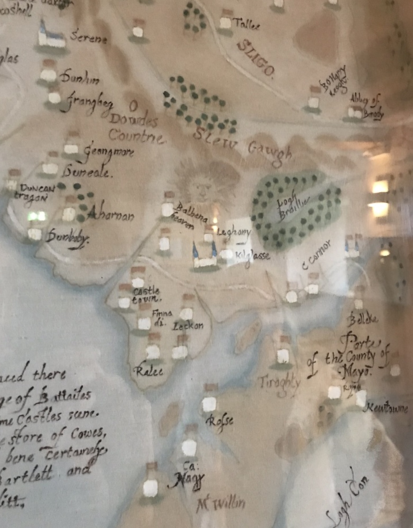
In the centre of O Dowdes Countrie, drawn over the Ox Mountains side of the territory, is a large radiant sun. Not a compass rose. Not a decorative flourish in the corner. A sun — drawn deliberately, with a face — sitting on top of the land. And when its position is overlaid against modern coordinates, it sits where Carn Amhalghaidh stands today.
Carn Amhalghaidh is the cairn from which the Ó Dubhda chiefs were inaugurated in the medieval period. It is the seat of kingship of the clan. If the sun on Baxter’s map is what we believe it might be, the cartographer in 1600 was marking, in the most universal of symbols, the place where the kings of O Dowdes Countrie were made.
What this is, and what it isn’t
We want to be honest about what this is and is not.
It is a hypothesis. The sun could be decorative. Period maps sometimes include sun and moon flourishes that mean nothing more than here be sky. Baxter himself was an English military surveyor working in hostile country, and his motives in marking that point may not have been ceremonial at all. We have not yet found a contemporary record stating that the sun on this map represents the inauguration mound.
What we can say with confidence is this: of all the places on a map of north Connacht the cartographer could have placed a large radiant sun, he placed it on the one square mile of land the Ó Dubhda kings considered the centre of their world. That is not nothing.
This is also, as far as we can tell, the first time AI has surfaced something for our clan that we could not have surfaced alone. We would have walked past that sun a hundred more times. I had walked past it. The map is dense. The flourish reads as ornament. Without the spatial overlay, the correspondence does not jump out. The machine held its attention where ours had drifted — and where Conor’s earlier research had pointed, but stopped just short.
But AI cannot finish this work. It can only point. The next step belongs to the ground.
We are looking for an archaeologist
We need someone qualified to walk Carn Amhalghaidh — not as tourists, which we have done many times, but with the eye and the instruments of the discipline. Geophysical survey, careful surface examination, comparison with documented inauguration landscapes elsewhere in Ireland. The mound is unexcavated. There is much the soil could tell us that the cartographer in 1600 may already have known.
If you are an archaeologist with an interest in Gaelic Ireland’s inauguration landscapes, or you know one whose work touches on this period, we would be glad to hear from you.
If you would like to sponsor a survey — even a preliminary one — we would be glad to hear from you also. The clan has the will but not yet the funds.
If you have other information — a folklore record, a manuscript reference, a mapmaker’s note we have not seen — please write to us.
The map has been hanging in Parke’s Castle for years. The sun was there the whole time.
I had walked past it with my children. Conor had used the map for other things. None of us saw it.
We just had a new way to look.
— Sean O’Dowda Stephens, the current Taoiseach