Dunneill Castle, Dromore West
May 2, 2026 2026-05-07 2:24Dunneill Castle, Dromore West
DUNNEILL CASTLE
Dunneill Castle, Dromore West
Dún Neill — “Niall’s Fort” — Castle No. 11 of the Ó Dubhda Kingdom
In the townland of Dunneill, just east of Dromore West in the Barony of Tireragh, County Sligo, lies the site of one of the twenty castles that once ringed the Ó Dubhda kingdom of Uí Fhiachrach Muaidhe. The very name of this place — Dún Neill, meaning “Niall’s Fort” — speaks of a fortification that may predate the medieval castle itself, possibly reaching back to the era of Niall of the Nine Hostages, from whose brother Fiachra the Ó Dubhda clan descends.
I. The Place: Dunneill Townland
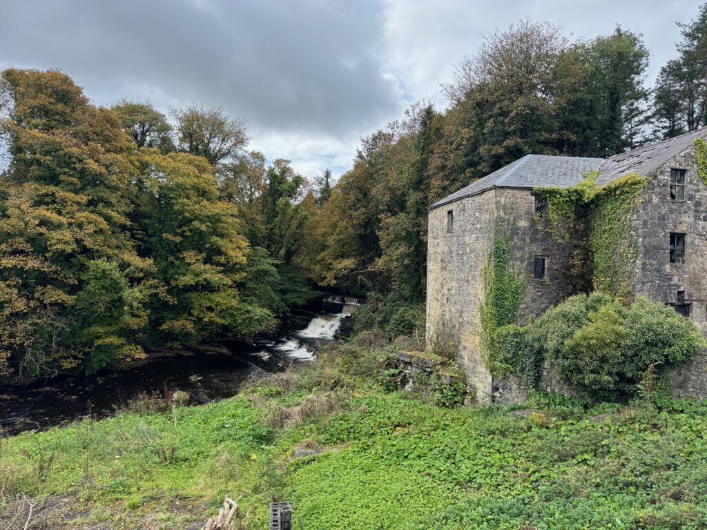
The castle site sits in the northern part of the townland of Dunneill, within the civil parish of Kilmacshalgan (Cill Mhac Sealgáin) in the Barony of Tireragh — the ancient heartland of the Ó Dubhda clan. The Dunneill River, which takes its name from the same townland, flows through nearby Dromore West on its way to the sea.
Historical spellings of the townland name reveal its long presence in the record: Downeneale (1585), Doneyll (1589), Duneneale (1603), Dooniell (from the Down Survey, 1655–7), and finally the modern standardised form Dunneill. Each iteration preserves the core Irish elements: Dún (fort) and Neill (of Niall).
II. The Castle: An Ó Dubhda Stronghold
Dunneill Castle appears as castle No. 11 — listed under the name “Dromore” — in the roster of twenty castles compiled by Clan Ó Dubhda historian Conor Mac Hale in The Ó Dubhda Family History (1990). Mac Hale described how the Ó Dubhda chieftains “forged a kingdom in Uí Fhiachrach Muaidhe (Northwest Connacht) which they ringed with 20 castles, often referred to as ‘ten-pound castles.'”
The term “ten-pound castle” refers to a 1429 statute under Henry VI that offered a subsidy of £10 to anyone who built “a sufficiently embattled or fortified castle or tower house” of minimum dimensions — 20 feet long, 16 feet wide, and 40 feet high. While originally intended for the Pale counties, the tower house style spread throughout Ireland and was widely adopted by Gaelic chieftains, including the Ó Dubhda. This places the likely construction period for many of the Ó Dubhda tower houses in the 15th century.
Dunneill Castle sat squarely within the Ó Dubhda domain. The clan’s territory of Tireragh (Tír Fhiachrach, “the land of Fiachra”) was named after their ancestor Fiachra, the elder half-brother of Niall of the Nine Hostages. It is intriguing — though unconfirmed — that the “Niall” in Dún Neill may refer to Niall of the Nine Hostages himself, or to a descendant of his lineage. If so, the fort may have existed long before the medieval castle was raised upon it.
III. The Historical Record
The most important primary source for Dunneill Castle comes from John O’Donovan, the renowned Irish scholar who travelled Ireland in the 1830s recording placenames for the Ordnance Survey. In his 1836 field notes for County Sligo (preserved as MS 14 F. 14 at the Royal Irish Academy), O’Donovan recorded:
“The [remains] of an old castle here” in the Dunneill townland.
“A river called by the name of townland runs through [it]; site of Duneal old castle is in the north of this townland.”
This confirms that castle remains were visible in 1836, that the castle was in the northern part of the Dunneill townland, and that the Dunneill River — which flows through Dromore West — takes its name from the same place.
The Wikipedia article on Dromore West also confirms “ringfort and tower house sites in the townlands of Dromore, Knockaculleen and Dunneill,” further corroborating the archaeological record.
IV. What Remains Today
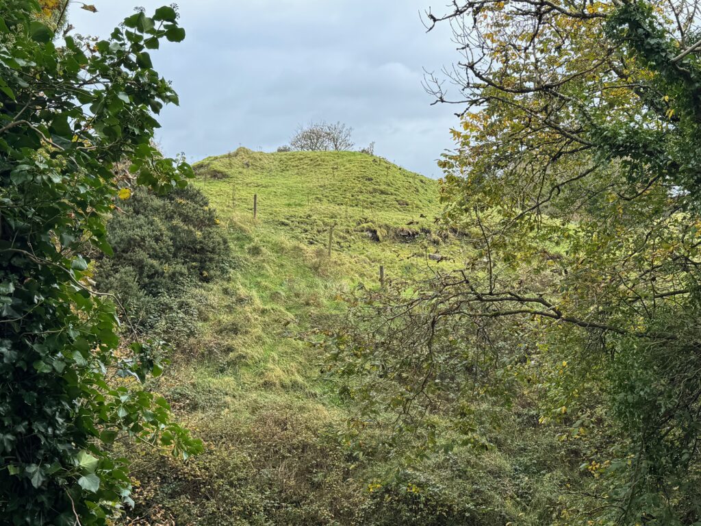
Today the castle site presents as a raised grassy mound, visible from the surrounding landscape but overgrown and without substantial standing walls. This is consistent with many of the smaller Ó Dubhda tower houses, which were reduced to foundations or earthworks over the centuries — particularly during the Cromwellian campaigns of the 1640s and 1650s, when Gaelic strongholds across Connacht were systematically slighted.
The site is on private farmland near the Dunneill River. While not a formal heritage attraction, it is an important archaeological site and a tangible connection to the Ó Dubhda past. The nearby Dunneill River Walk, a scenic amenity following the river from Dromore West, passes through this landscape.
Important note: As with many of the 20 castle sites, the present remains may not correspond precisely to the original Ó Dubhda fortification. The “fort of Niall” may have been an older ring fort upon which a later tower house was built, and centuries of agriculture and natural weathering have altered the landscape considerably. What we see today is a site of memory as much as a site of archaeology.
V. The Wider Landscape
Dunneill Castle sits within a rich archaeological landscape. The Ox Mountains rise to the south; the Atlantic coast lies approximately 5 km to the northwest. The townland of Crowagh or Dunneill Mountain — the 4th largest townland in County Sligo at 12.66 km² — borders Dunneill to the south, covering the mountainous terrain above.
Nearby Ó Dubhda castle sites include Roslee Castle at Easkey (No. 10) and Rathlee Castle (No. 9), forming a chain of coastal and inland fortifications that once protected the western flank of the Ó Dubhda kingdom.
Dunneill Castle — Dromore West, Tireragh
Dunneill Castle
Dún Neill (Niall's Fort)
54°14'54.5"N, 8°52'24.3"W
Dunneill townland, Parish of Kilmacshalgan
Near Dromore West, County Sligo, Ireland
Tower House / Fortification site
Castle No. 11 on the Mac Hale list of 20 Ó Dubhda castles
Likely a "ten-pound castle" (15th century)
Fort site may predate the medieval period
Tower house likely 15th century
Named after Niall — possibly Niall of the Nine Hostages (d. c. 405 AD)
Raised grassy mound — no substantial standing walls
O'Donovan recorded "remains of an old castle" in 1836
Reduced to earthworks, likely slighted during the Cromwellian period
On private farmland near the Dunneill River
Not a formal heritage site
The Dunneill River Walk passes through the area
Direct Ó Dubhda castle in the Barony of Tireragh
Part of the defensive ring of 20 castles protecting Uí Fhiachrach Muaidhe
Between Roslee Castle (Easkey) and Rathlee Castle in the chain
Named for Niall, kin to the Ó Dubhda ancestor Fiachra
Though reduced to a mound, Dunneill is one of the most evocatively named of the Ó Dubhda castles. The placename itself — "Niall's Fort" — connects us across fifteen centuries to the dynasty from which the Ó Dubhda descend, making this site a profound link between the clan's deepest origins and its medieval flowering in Tireragh.
From the Clan
Photographs of Dunneill Castle submitted by clan members.
A Note from the Clan
These pages are researched and written by volunteers of the Ó Dubhda Clan. Our history is vast, and our understanding of it grows with every correction, addition, and story shared by clan members and researchers.
If you have found an error, or have information that would improve this page, please get in touch.