Maps
April 16, 2026 2026-05-07 1:56Maps
MAPS
the O'Dubhda in the Irish cartographic record
A catalogue of historical maps of Ireland that name the O'Dubhda, depict our castles, or record the territory we ruled along the River Moy from the ninth to the seventeenth century.
Two of the maps below — Boazio 1606 and Speed 1610 — name the O'Dubhda chief directly, as O Dondey, on the Sligo coast. Others show our kingdom without labelling the family. Taken together they form the earliest continuous printed record of our country.
For the story behind the spelling, read On the Maps: how we became “O Dondey”.
Four centuries on paper
Chronological, oldest first. Click any image for the full map.
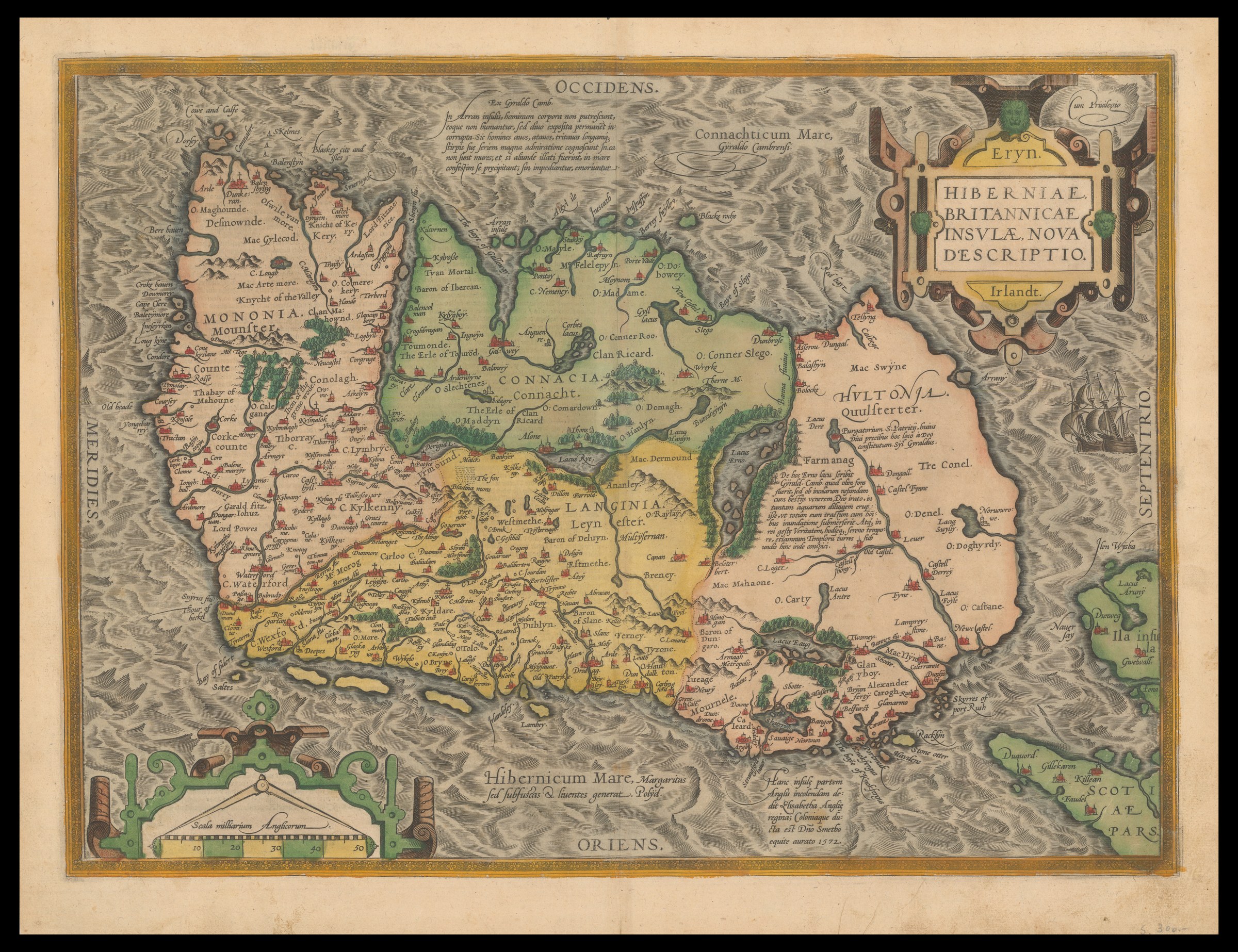
Eryn. Hiberniae Britannicae Insulae Nova Descriptio
Source: Bibliothèque nationale de France, via Wikimedia Commons. Public domain.
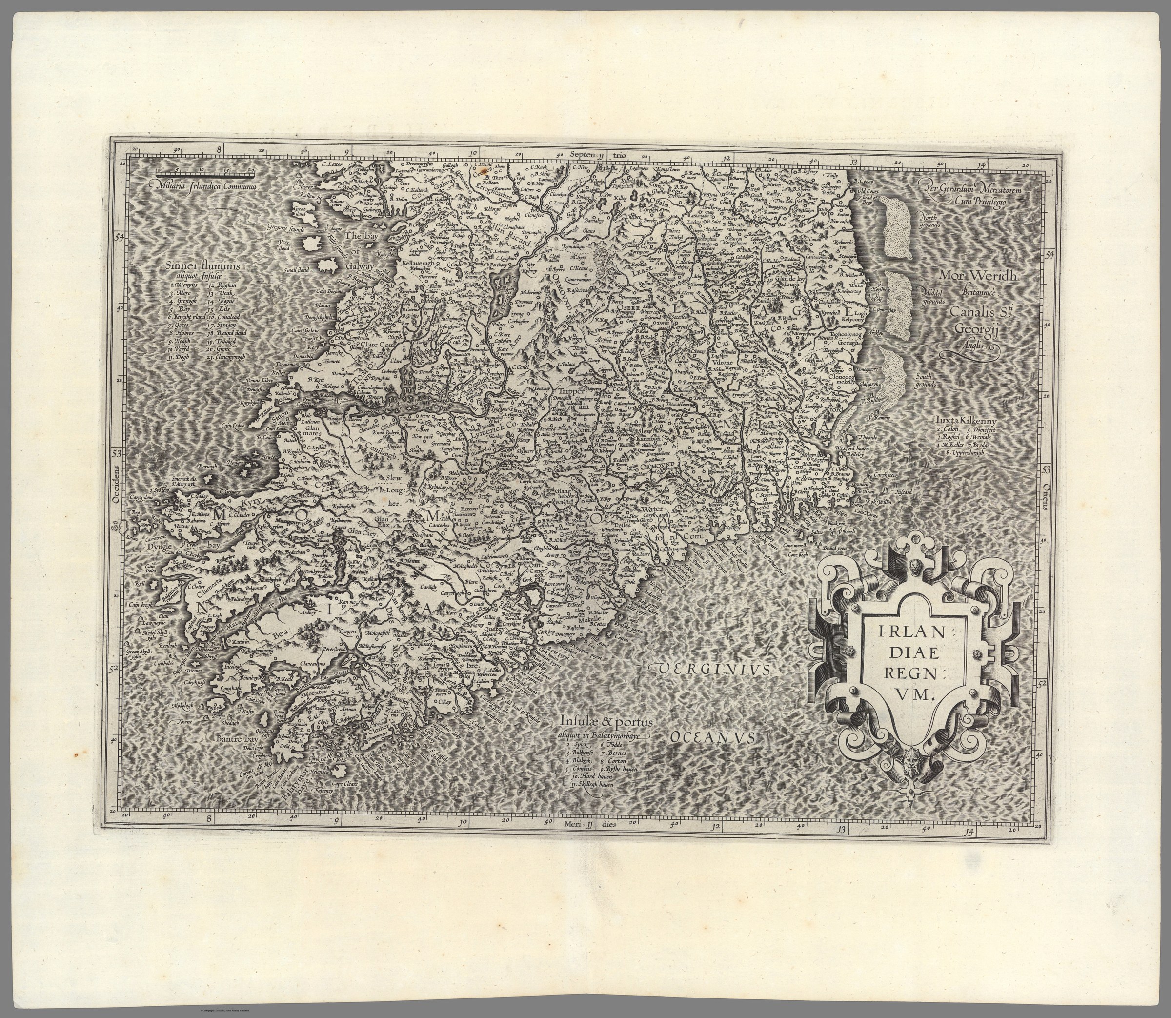
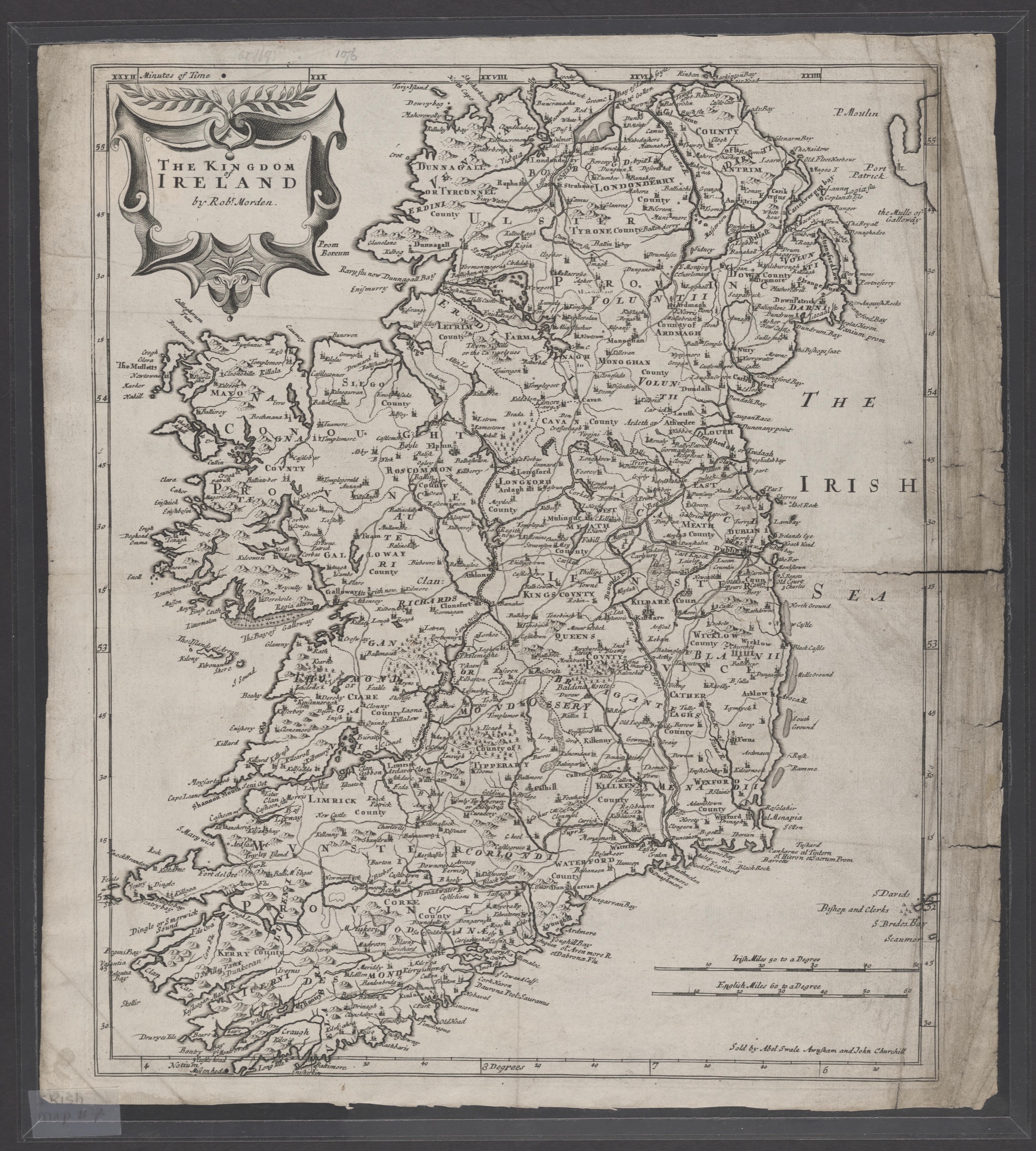
Irlandiae Regnum
Source: David Rumsey Map Collection, Stanford Libraries, via Internet Archive. CC BY-NC-SA 3.0.
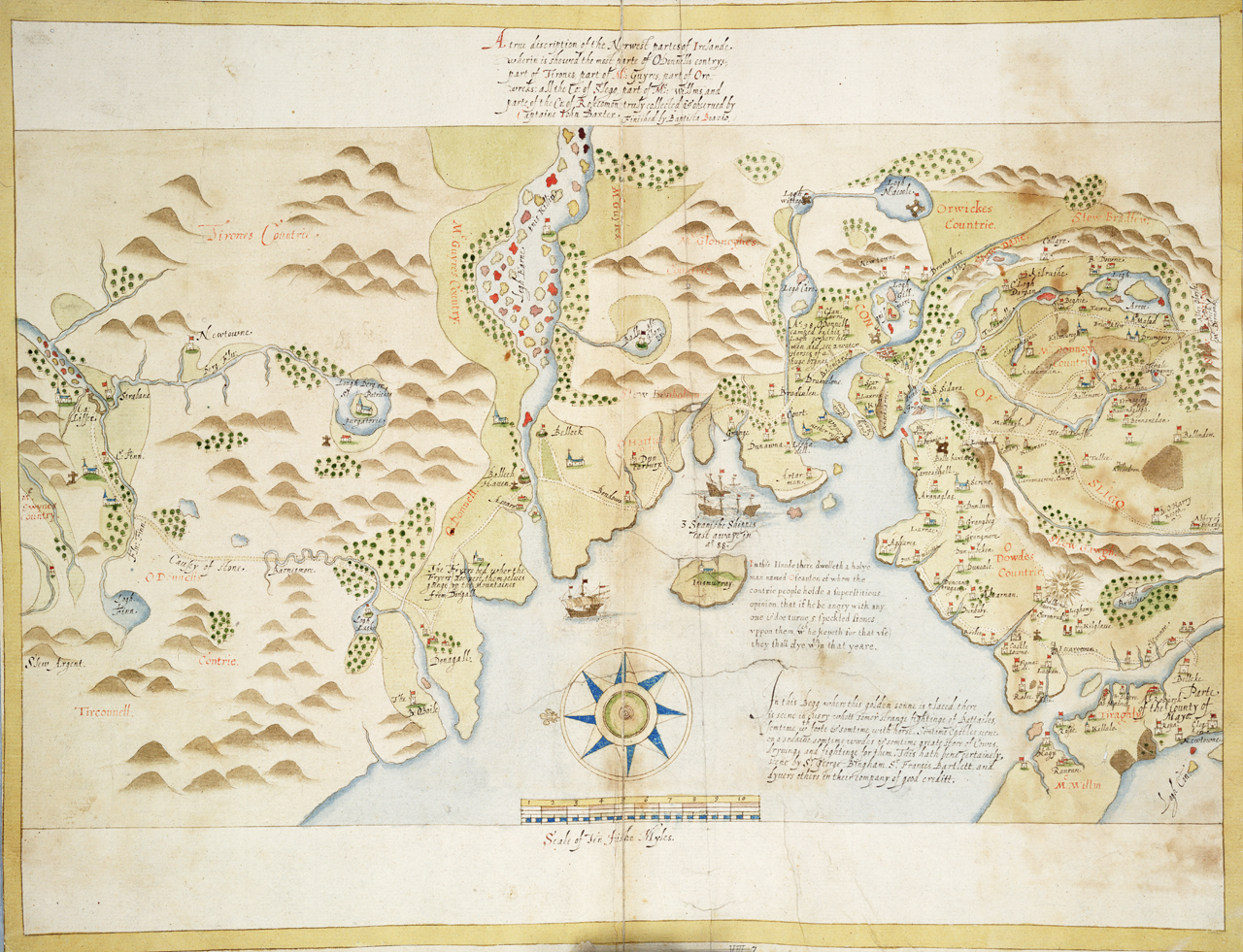
A true description of the Norwest partes of Irelande
Source: Royal Museums Greenwich, Dartmouth Collection P/49(7). Public domain.
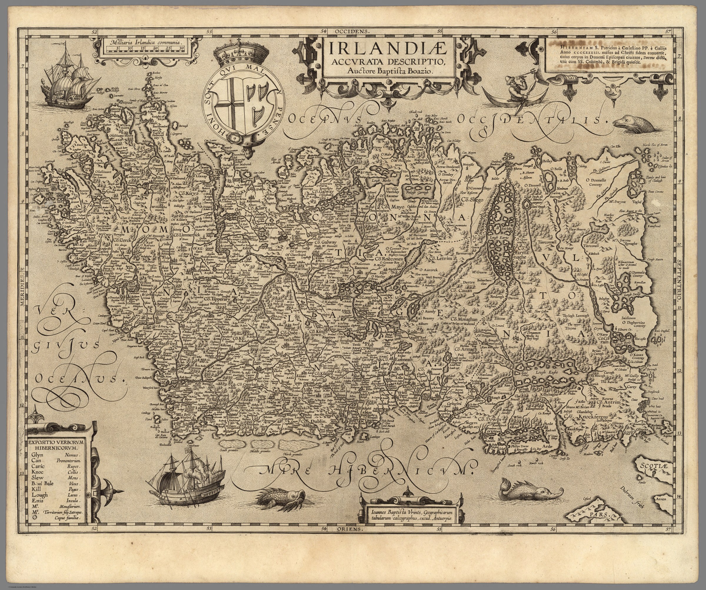
Irlandiae Accurata Descriptio
Source: David Rumsey Map Collection, Stanford Libraries. CC BY-NC-SA 3.0.
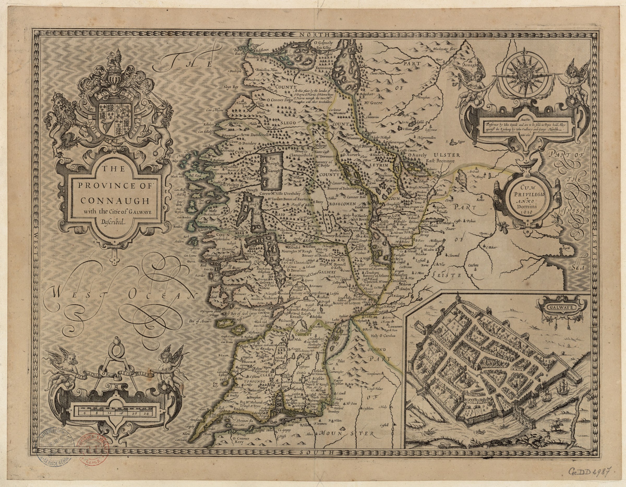
The Province of Connaught with the Citie of Galwaye Described
Source: Bibliothèque nationale de France (btv1b53057005d), via Wikimedia Commons. Public domain.
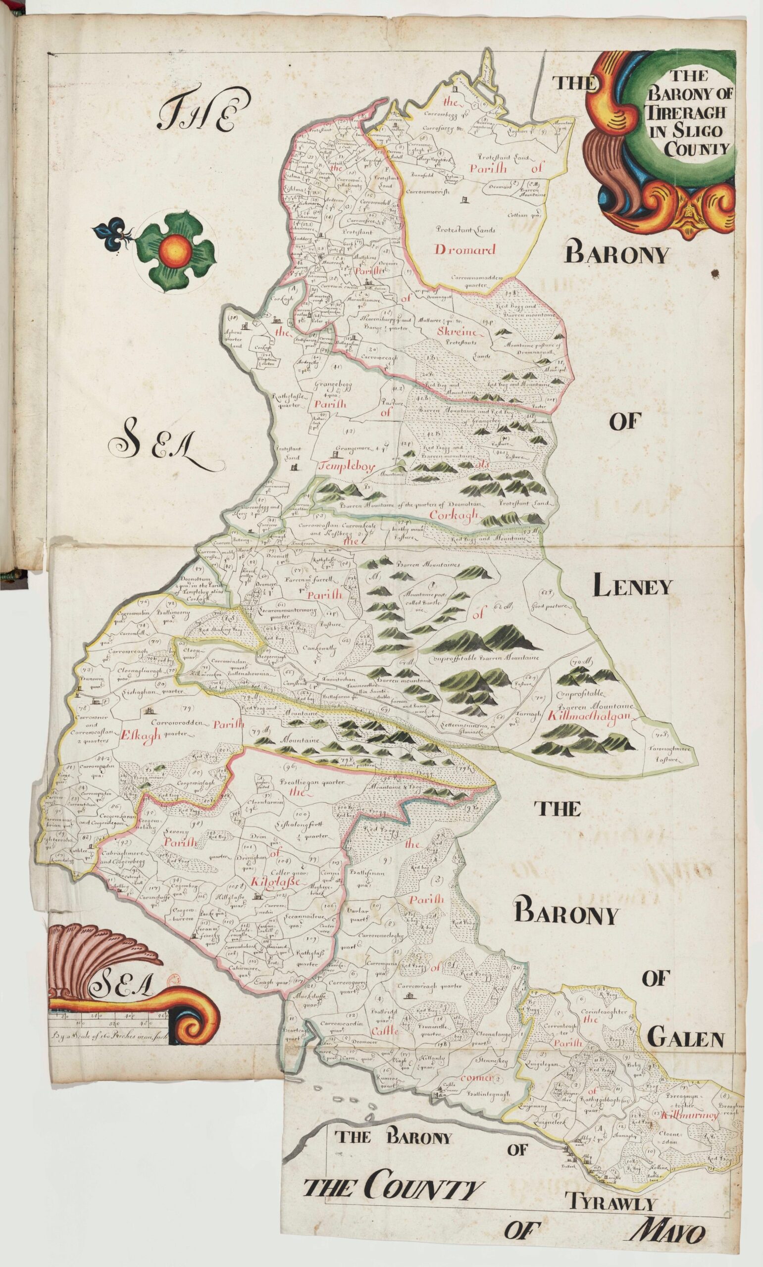
The Barony of Tireragh in Sligo County
The accompanying description, preserved in the Down Survey terriers, describes Tireragh and Carbury as “lying upon the sea coast, devided from the barony of Tirerill . . . by a great mountaine” — a small window into how the surveyors understood the landscape we still walk today.
Source: Bibliothèque nationale de France (MSS Anglais 1), digitised by the Down Survey of Ireland Project, Trinity College Dublin. Stitched from Zoomify tiles for display here.
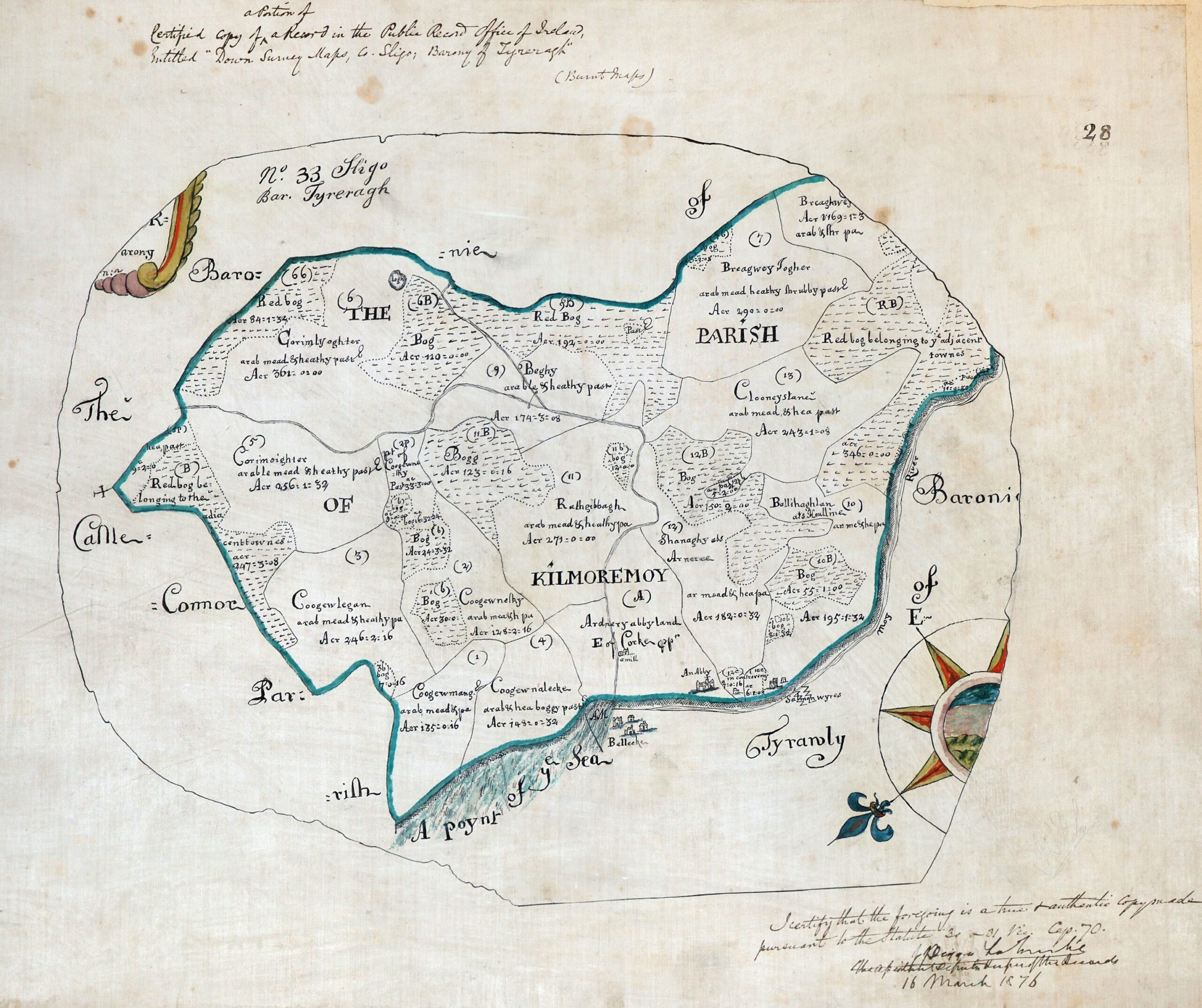
Parish of Kilmoremoy, Barony of Tireragh
Source: National Archives of Ireland (QRO 1/1/3/18), digitised by the Down Survey of Ireland Project, Trinity College Dublin. Public domain.
The Kingdom of Ireland
Source: University of Wisconsin Digital Collections, via Wikimedia Commons. Public domain.
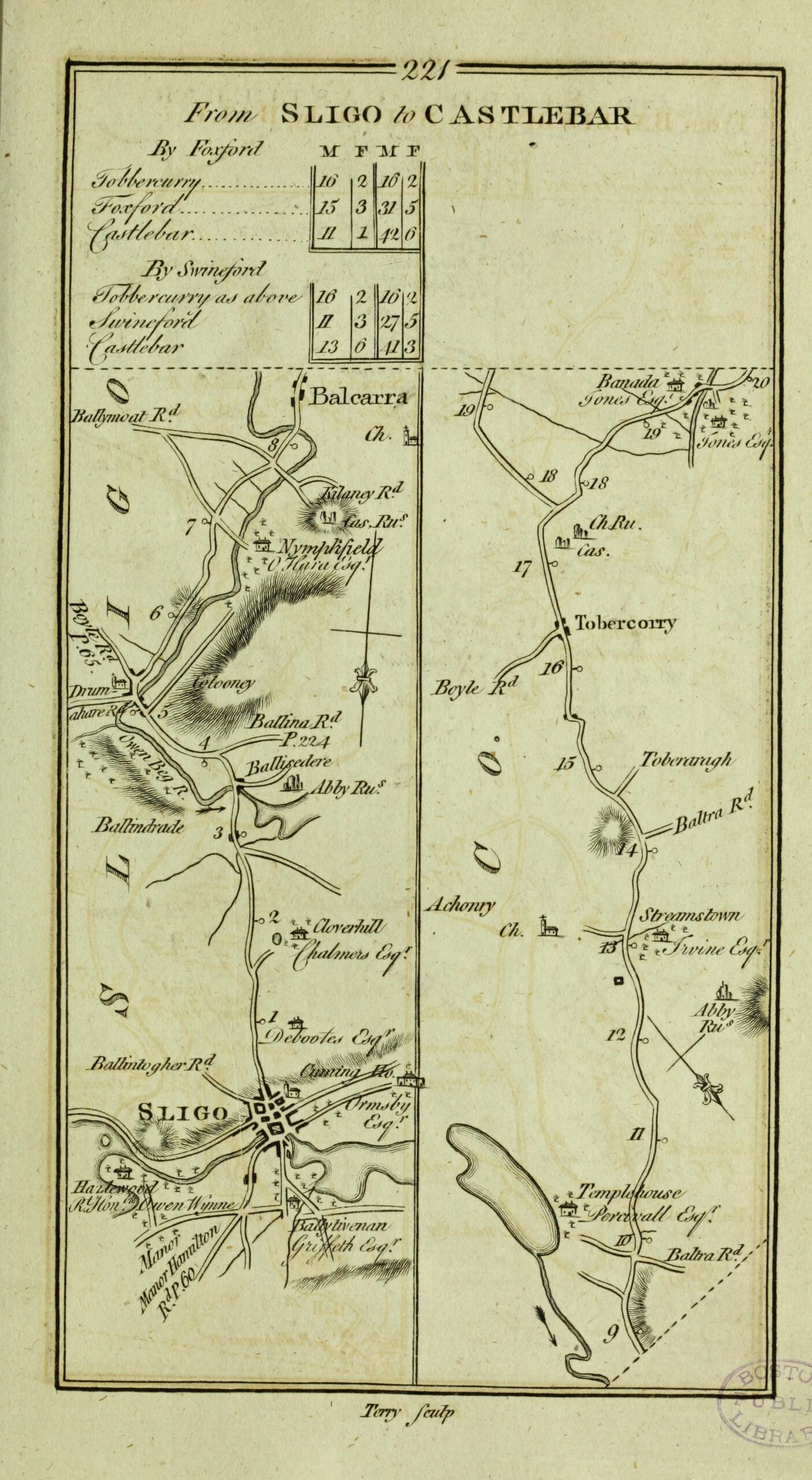
From Sligo to Castlebar
Source: Full scan at Internet Archive. Public domain.
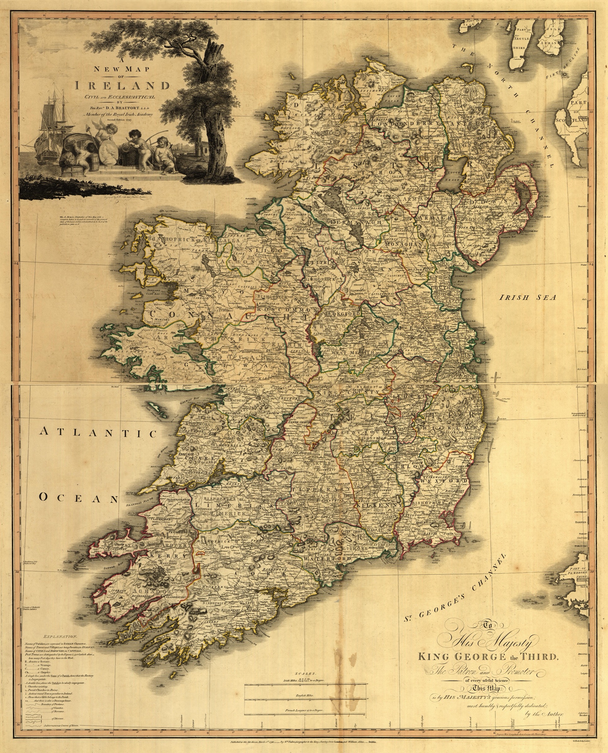
A New Map of Ireland Civil & Ecclesiastical
Source: Library of Congress, Geography & Map Division (g5781f ct000402). Public domain.
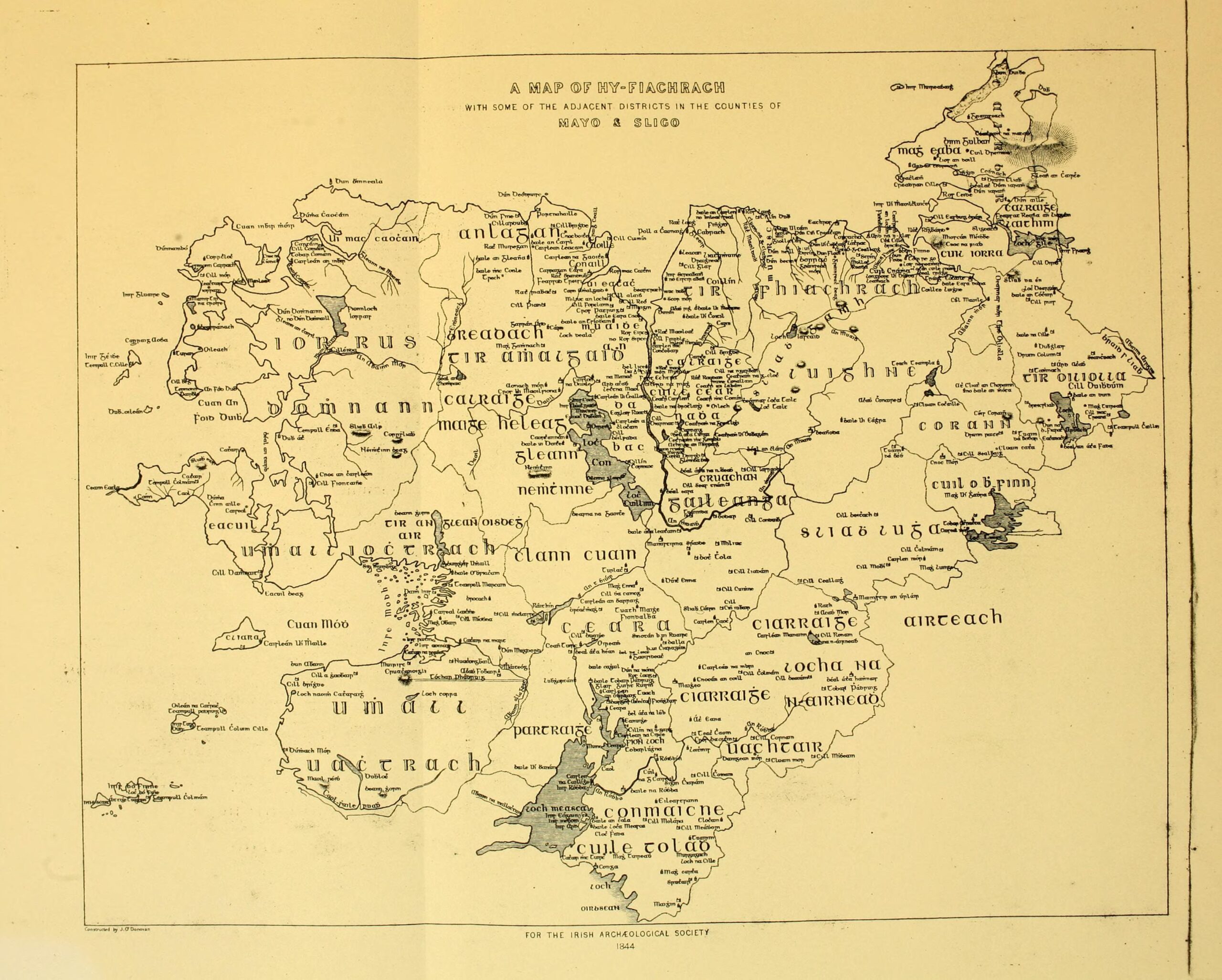
A Map of Hy-Fiachrach, with some of the adjacent districts in the counties of Mayo & Sligo
Source: Internet Archive (genealogiestribe44macf). Public domain.
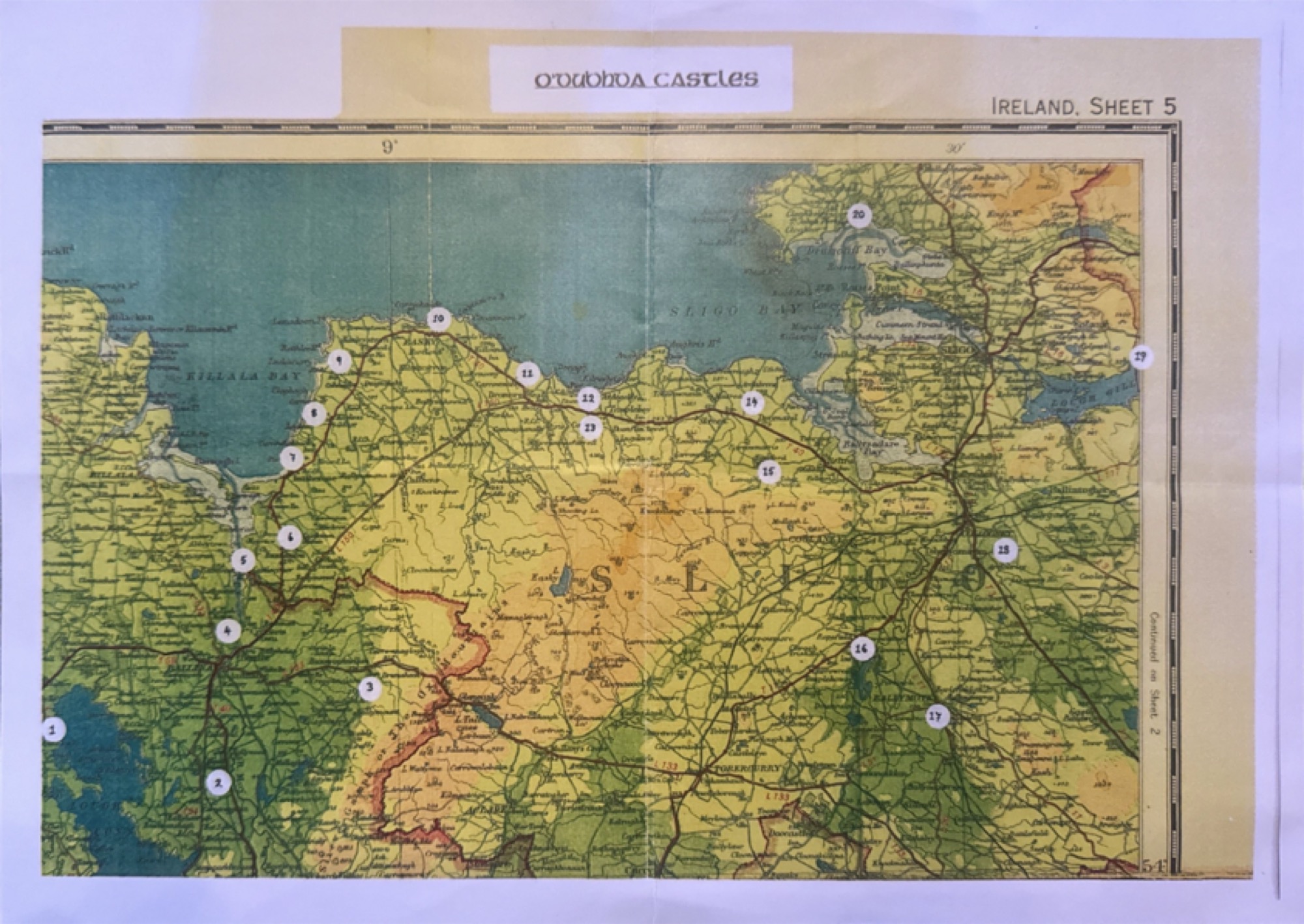
O’Dubhda Castles — Ireland, Sheet 5
A note on what the map does and does not say: several of the twenty pins mark later buildings standing near, but not on, the original castle site — and a handful are sites for which the castle itself has never been located on the ground. Mac Hale's map is a research index, not a field survey. A full archaeological re-survey of the O’Dubhda territory has not been carried out since.
Source: Conor Mac Hale, The O’Dubhda Family History (1990). Reproduced from the Internet Archive scan. Courtesy the author.
Maps we are still chasing
Each of these is relevant to the O'Dubhda story and will be added to the catalogue as we gather clean scans and verify their content.
Eighteenth-century Sligo county map
A black-and-white county map photographed in a Dublin print shop showing TYrerach, Leney, Castle Conner, Rath lee, Kilnegarvan, Cashelboy, Callen and Moygara — a striking concentration of O'Dubhda placenames. Working hypothesis: Bernard Scalé's Hibernian Atlas Sligo plate (1776); the typography and hatching match, but the title cartouche in the reference scans differs, so attribution remains open.
Research in progress — attribution not yet confirmed.
First-edition 6-inch, Sligo & Mayo
The Ordnance Survey six-inch sheets covering Tireragh and Tirawly record every standing castle ruin, holy well, townland boundary and road in our country at the moment of the Great Famine — the reference layer underlying every modern Irish map. Sheets are available on the National Library of Scotland viewer and OSi GeoHive, but the correct Tireragh sheet numbers have not yet been identified and clipped for this catalogue.
Available via NLS, OSi GeoHive, and logainm.ie.
Do you know another map?
If you know of an antique or historical map where the O'Dubhda appear by name — or where one of our castles or townlands is shown — we would love to hear from you.
From the Blog
Research and stories from the O’Dubhda blog — beginning with the story of the name itself.
On the Maps: how we became “O Dondey”
On two early-seventeenth-century maps of Ireland — Speed 1610 and Boazio 1606 — the O’Dubhda chief appears on the Sligo coast under an unfamiliar English spelling. A story of sound, script, and a family on the page.
Read the story →
How Many Castles Did the O’Dowds Actually Have?
Every year another surfaces — a farmer mentions old walls in a field; a researcher cross-references a seventeenth-century map with a townland name. The commonly cited number is twenty. The honest answer is: we’re still counting.
Read the story →A Note from the Clan
This catalogue is volunteer-compiled. The scans shown here are sourced from public institutional collections and reproduced under their respective licences; full attribution is given on each entry.
New entries are added as new maps surface. If you know of one we have missed, please tell us.

